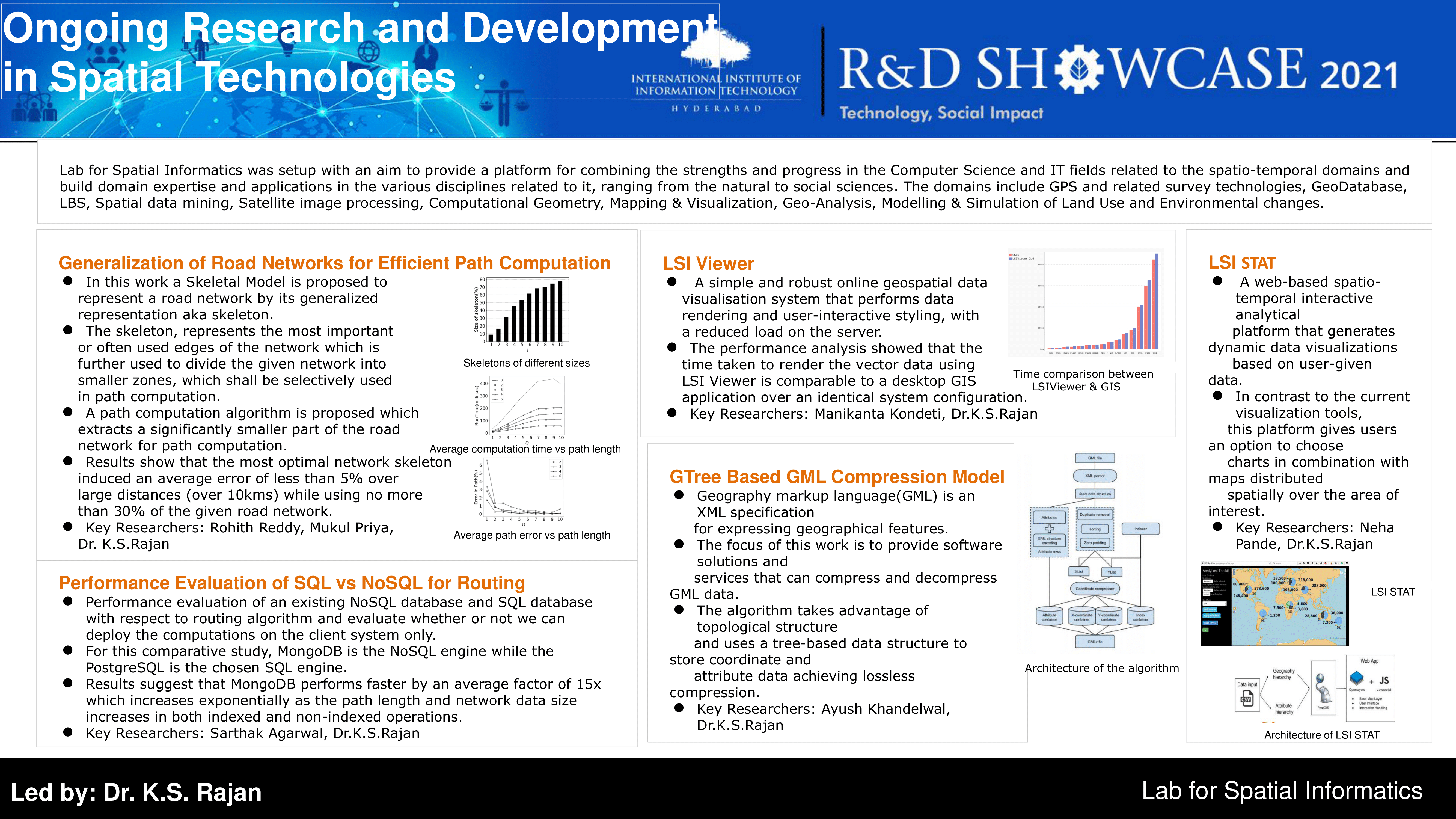
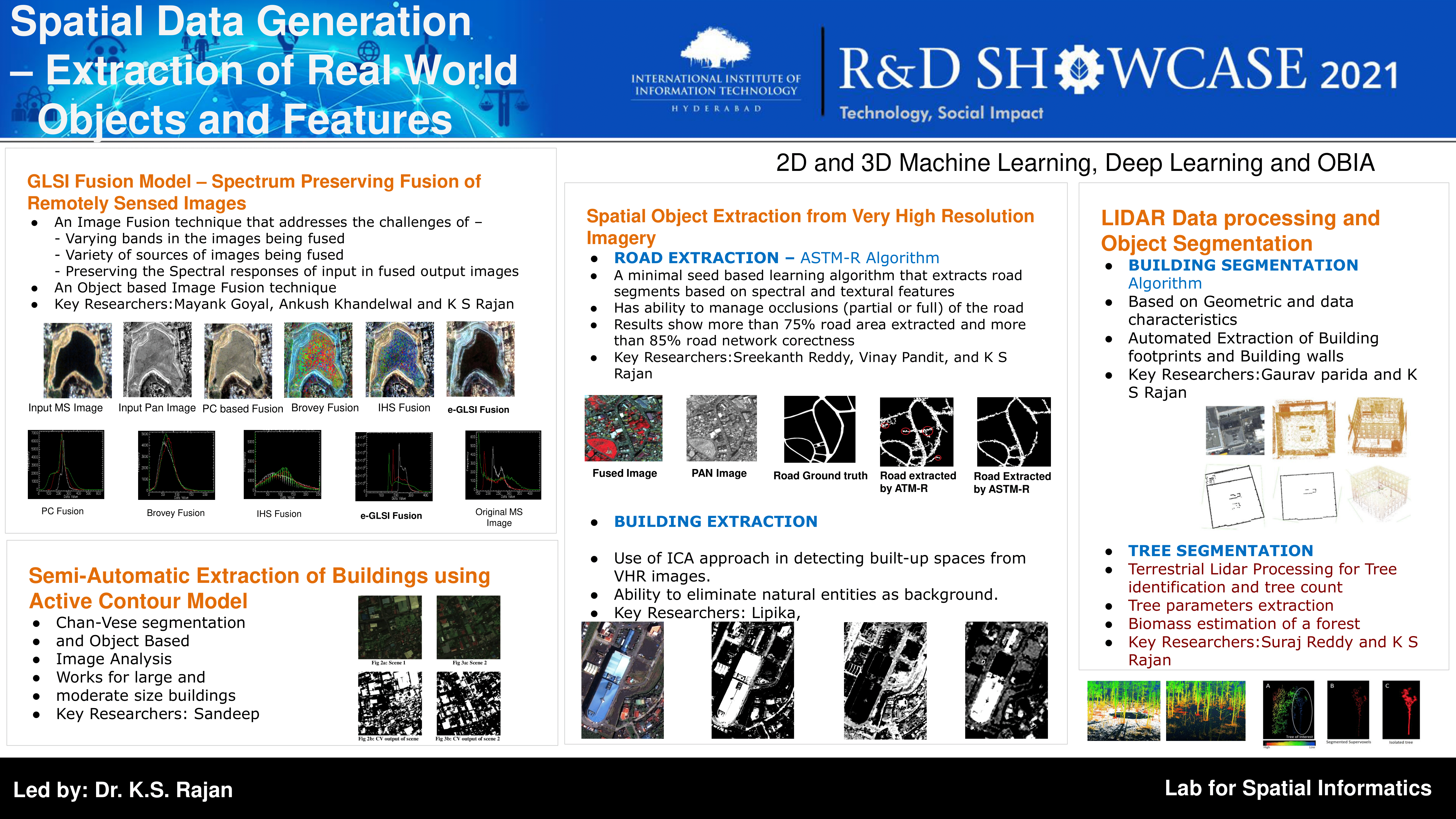
Lab for Spatial Informatics(LSI) is the only centre/group of its kind in India promoting GeoSpatial Research efforts at both system and applied levels since 2006, and has gained recognition for the same in India and outside. The suite of technologies that encompass this rapidly growing discipline of knowledge include data collection (GPS based field surveys, satellite imagery, etc.), data storage and management (GeoDB, spatial data mining), processing and manipulation (satellite image processing), mapping and visualization, data analysis (Geospatial Information Systems), simulation and modelling.